| Antique Prints | Autographs | Rare Books | Connecticut | Law |
| Maps | Miscellaneous | Newspapers & Magazines | Historical Memorabilia | Political |
| World War I Posters | World War II Posters |

|
|
|
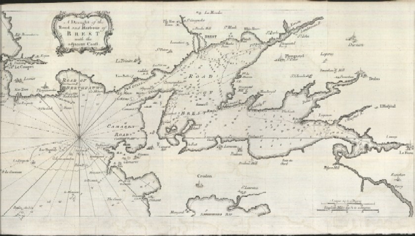
"A Draught of the Road and Harbour of Brest with the Adjacent Coast"
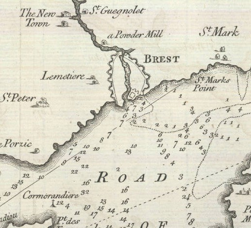
Below is a close-up of the area around the City of Brest. The map labels the water depth in the bays and seas around Brest.
Date: 1757 Price: $40 Pay securely with credit card through PayPal by clicking the button below
|