| Antique Prints | Autographs | Rare Books | Connecticut | Law |
| Maps | Miscellaneous | Newspapers & Magazines | Historical Memorabilia | Political |
| World War I Posters | World War II Posters |

|
|
|
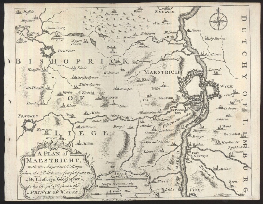
A Plan of Maestricht, with the Adjacent Villages, where the Battle was Fought June 21. By T. Jefferys, Geographer to His Royal Highness the Prince of Wales
The modern spelling of the area covered in this map is Maastricht.
Date: 1747 Price: SOLD
|