| Antique Prints | Autographs | Rare Books | Connecticut | Law |
| Maps | Miscellaneous | Newspapers & Magazines | Historical Memorabilia | Political |
| World War I Posters | World War II Posters |

|
|
|
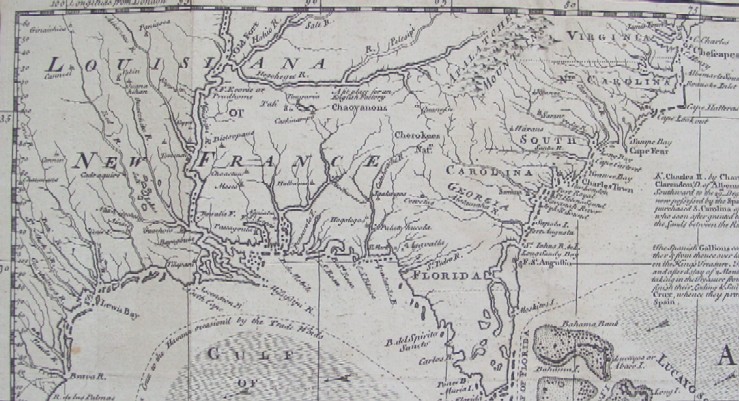
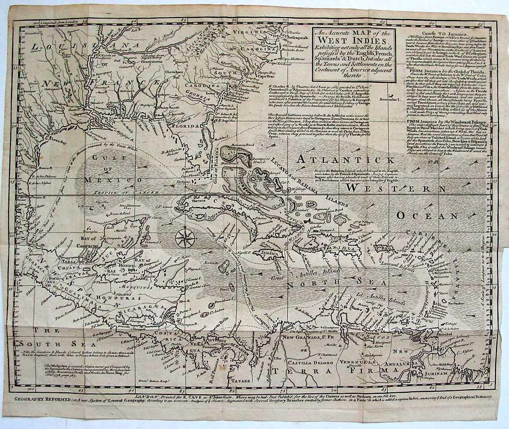
"An Accurate Map of the West Indies. Exhibiting Not Only All the Islands Possess'd by the English, French, Spaniards & Dutch, but also All the Towns and Settlements on the Continent of America Adjacent thereto" Below is the portion of the map the covers the current United States.
Below is the entire map.
Date: 1740 Price: $350
|