| Antique Prints | Autographs | Rare Books | Connecticut | Law |
| Maps | Miscellaneous | Newspapers & Magazines | Historical Memorabilia | Political |
| World War I Posters | World War II Posters |

|
|
|
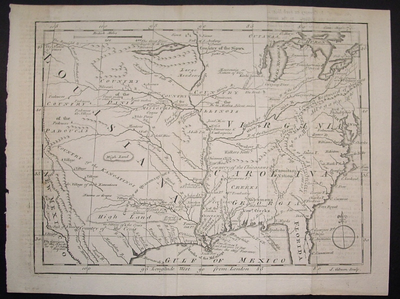
Louisiana, Virginia & Carolina
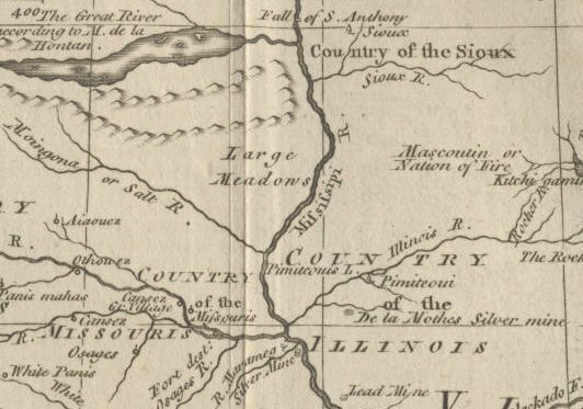
This rare early map pictures the East Coast south of New England and Louisiana (then Spanish territory) and the areas west of the 13 original states, including parts of New Mexico, Colorado, Wyoming and Montana in addition to all of the current states of Texas, Oklahoma, Missouri, Mississippi, Alabama, Tennessee, Illinois, Indiana, Iowa, Wisconsin, Minnesota, Ohio, Kansas, Nebraska and North and South Dakota. The map labeled the major known Indian tribes in each area. Below is a close-up of that portion of the map in the upper Midwest.
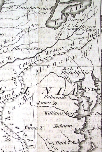
Below is a close-up of the Eastern part of the map from Pennsylvania to Virginia with the famous line the King made in 1763 to divide the American colonists from the Indians.
Date: 1763 Price:$425
|