| Antique Prints | Autographs | Rare Books | Connecticut | Law |
| Maps | Miscellaneous | Newspapers & Magazines | Historical Memorabilia | Political |
| World War I Posters | World War II Posters |

|
|
|
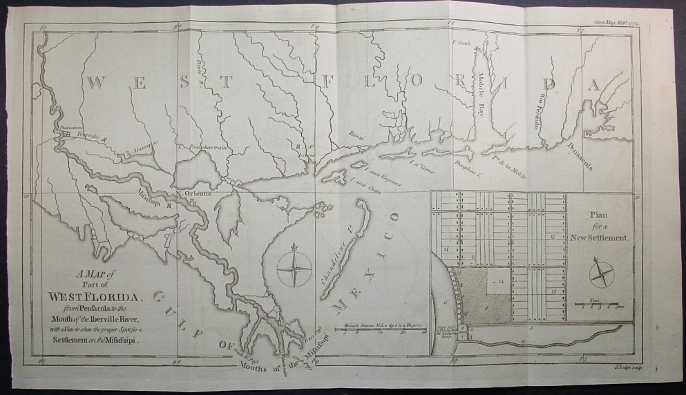
"A Map of Part of West Florida, from Pensacola to the Mouth of the Iberville River, with a View to Shew the Proper Spot for a Settlement on the Mississipi"
Map shows not only the western part of Florida but the southern portions of the current states of Alabama (Mobile Bay), Mississippi and Louisiana (New Orleans). This map is in great condition with folds as issued. Date: 1772 Price: $350
|