| Antique Prints | Autographs | Rare Books | Connecticut | Law |
| Maps | Miscellaneous | Newspapers & Magazines | Historical Memorabilia | Political |
| World War I Posters | World War II Posters |

|
|
|
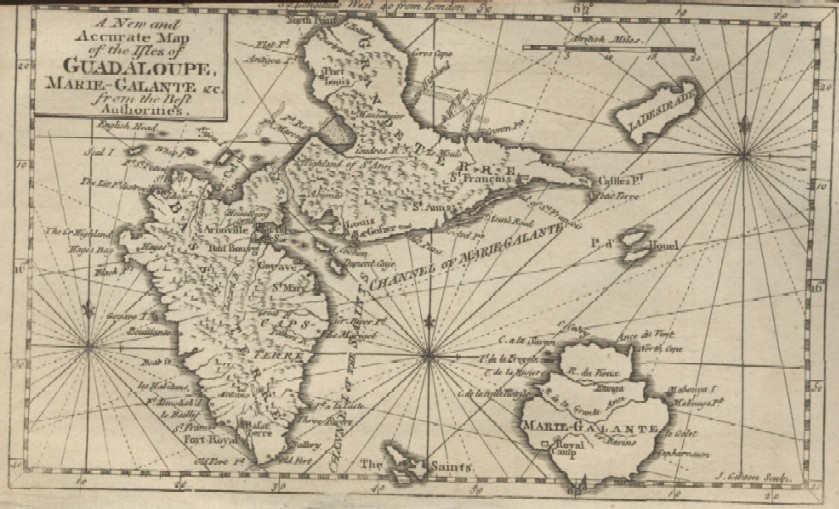
"A New and Accurate Map of the Isles of Guadeloupe, Marie-Galante &c. from the Best Authorities"
Date: 1759 Price: SOLD
|