| Antique Prints | Autographs | Rare Books | Connecticut | Law |
| Maps | Miscellaneous | Newspapers & Magazines | Historical Memorabilia | Political |
| World War I Posters | World War II Posters |

|
|
|
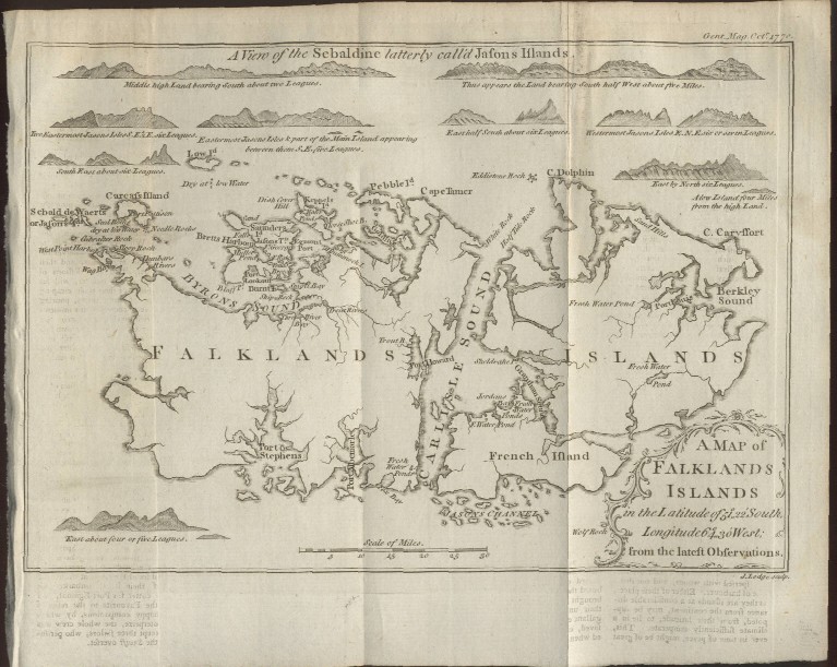
"A Map of Falkland Islands in the Latitude of 51°, 22' South, Longitude 64°, 30' West; from the Latest Observations"
Date: 1770 Price: $110 Pay securely with credit card through PayPal by clicking the button below
|