| Antique Prints | Autographs | Rare Books | Connecticut | Law |
| Maps | Miscellaneous | Newspapers & Magazines | Historical Memorabilia | Political |
| World War I Posters | World War II Posters |

|
|
|
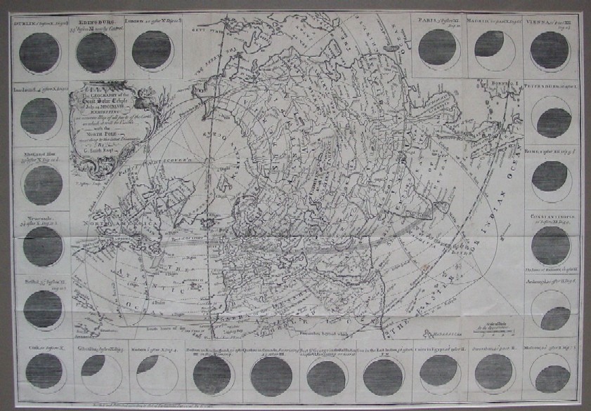
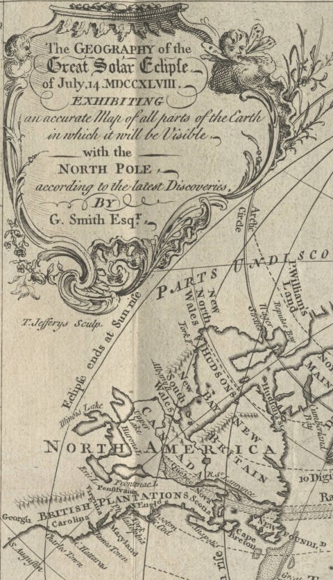
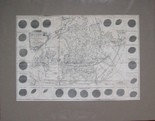
"The Geography of the Great Solar Eclipse of July, 14. MDCCXLVIII. Exhibiting an Accurate Map of All Parts of the Earth in which it will be Visible with the North Pole According to the Latest Discoveries. By G. Smith Esqr."
Below is a portion of this fine 1748 map engraved by Thomas Jeffrey that better reflects the color and texture and includes the title cartouche and the eastern portion of North America from Canada to St. Augustine. Note that Lake Michigan is labeled as "Illinois Lake" and Lake Superior is labeled "Upper Lake." Note also that on the west side of Hudson's Bay is New South Wales, either for some perspective reason or hopes of finding a Northwest Passage.
Date: 1748 The map will come to you as shown below, matted and enclosed in a protective plastic sleeve. We can also take it out of the mat and send it to you folded as it had been for more than 250 years
Price: SOLD
|