Antique Maps, Plans and Views of Germany
Click on
the pictures or titles below to bring up a higher resolution map with more
information, price and a PayPal button to purchase the map via credit card or
bank transfer.
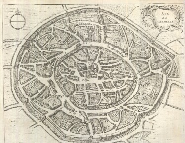
1748
Plan of Imperial City of Aix la Chapelle -
Aachen
Thomas Jeffrey's map with buildings pictured
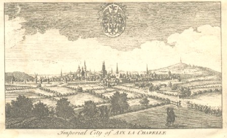
1748
View of Imperial City of Aix la Chapelle -
Aachen
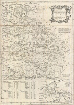
1756
"A Map of Bohemia, Moravia, Silesia, Lussatia,
with Great Part of Saxony & Brandenburg; Shewing the Present Seat
of War, in Germany"
Large 14 1/4 x 10" early map of Germany with inset
close-up of Prussian Army battle victory site
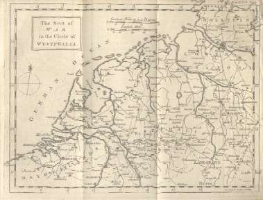
1757
"The Seat of War in the
Circle of Westphalia"
Map pictures modern day Netherlands (Amsterdam shown)
and northern Germany to Denmark
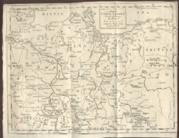
1757
"A Map of Upper Saxony Comprehending that
Part of Germany which is the Present Seat of War"
Map also shows part of modern Poland
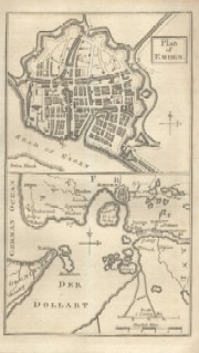
1758
Plan of Emden on plate with Emden Harbor
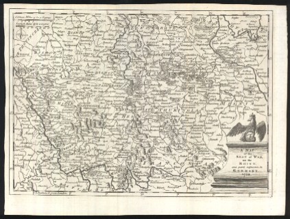
1758
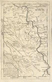
"A Map of the Rhine between Wesel & Duseldorp
Shewing the Country round Crevelt Where the Battle Was Fought between
the Allied & French Armies June 23, 1758"
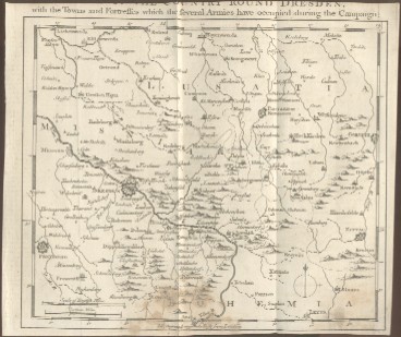
1758
"A Map of the Country round Dresden, with the
Towns and Fortresses Which the Several Armies Have Occupied during the
Campaign"
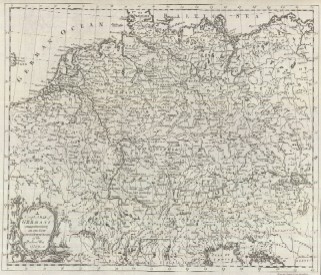
1759
"A Complete Map of Germany Comprehending in
One View the Different Seats of the Present War 1759"
1759
"A Map of the Seat of War on the Rhine, and
Part's Adjacent, in Germany, 1759"
1759
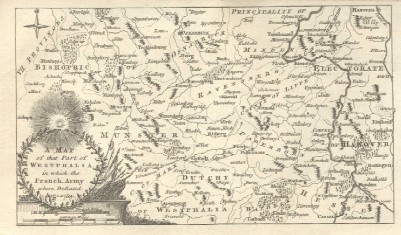
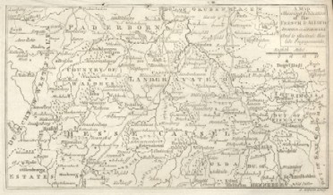
"A Map of That Part of Westphalia, in
Which the French Army Where Defeated Aug. 1, 1759"
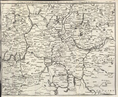
1760
"A Map of Brandenburg, Including
Berlin, and the Country Pillaged by the Russians."
1760
"A Map Shewing ye Situation of the
French & Allied Armies in Germany, And to Illustrate Their Late
Engagements"
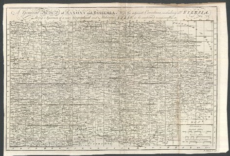
1760
"A General Map of Saxony and Bohemia,
with the Adjacent Countries, Including All Silesia. Being a Specimen of
a New Geographic and Military Atlas; to Be Continued Occasionally."
Four separate maps of Germany, a survey map and 3
detailed maps published in 1760